The problem nobody talks about
Most digital terrain models used in flight simulators are derived from 30-meter or 90-meter resolution datasets. For en-route flying, that's fine. But for approach and landing training, especially at airports surrounded by terrain, those numbers start to matter in ways that aren't immediately obvious.
Consider a pilot flying a visual approach to a runway with a 200 ft ridge two miles from threshold. If the terrain model places that ridge 5 meters too low, the pilot's sight picture changes. The ridge appears shorter relative to the runway, the visual cues for being on a correct glidepath shift, and the pilot builds muscle memory around an inaccurate picture. In a real cockpit, that mismatch could lead to a late correction or a misjudged go-around.
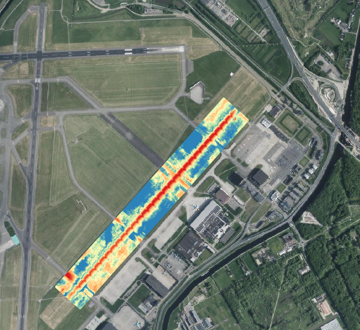
GIS elevation heatmap data — the raw terrain survey that drives accurate terrain modeling
What "resolution" actually means
Terrain data resolution refers to the spacing of elevation sample points in the source dataset. A 30-meter DEM has one elevation value for every 30-by-30 meter grid cell. Higher-resolution source data doesn't just add visual detail — it determines whether the elevation model captures the features that pilots actually use for orientation: ridge crests, cliff edges, threshold elevations, and the terrain gradients that define an approach profile.
An important distinction: source data resolution and rendered terrain resolution are not the same thing. Simulation platforms have their own mesh density limits — typically in the 5 to 10 meter range for how finely terrain changes are actually displayed. But starting with higher-resolution source data ensures that the elevation values at operationally critical points are correct, even when the rendering mesh is coarser. A 30-meter DEM might place a ridgeline 15 meters from its true position. A survey-grade source puts it where it belongs.
| Source resolution | What it captures | Approach training suitability |
|---|---|---|
| 90 m | General terrain shape, valleys, mountain ranges | Not suitable. Ridgelines and terrain features smoothed or missing. |
| 30 m | Major terrain features, hill contours | Marginal. Fine for en-route but unreliable near terrain-critical approaches. |
| 5-10 m | Individual ridges, cliff faces, embankments, runway gradients | Good. The practical sweet spot — captures operationally relevant features at the resolution simulation platforms can render. |
| 1-3 m | Precise ridgeline crests, threshold elevations, drainage features | Highest confidence. Ensures critical elevation points are correctly placed even after processing for the simulation mesh. |
Where the errors show up
Terrain errors have the biggest effect in three phases of flight: visual approach, circling approach, and missed approach. In each case, the pilot is making decisions based on what the terrain looks like relative to the runway and the aircraft's position.
On a visual approach, the pilot uses the relationship between terrain features and the runway to judge glidepath. A ridge, a coastline, a valley floor — these are natural glidepath indicators. If they're in the wrong place or the wrong height, the visual cues are wrong.
On a circling approach, the pilot is maneuvering at low altitude with terrain nearby. The circling area is defined by obstacle clearance surfaces that depend on the terrain being where the charts say it is. If the simulation terrain is different from the charted terrain, the pilot is practicing in a fictional environment.
A missed approach is the most critical case. When a pilot pushes the throttle forward and starts climbing, the margin between the aircraft and the terrain can be measured in hundreds of feet. If the simulation underrepresents terrain height, the pilot never trains for the actual visual picture during the most stressful phase of the approach.
The glidepath sight picture
Experienced pilots develop an instinct for what a correct approach looks like out the window. They can tell they're high or low before the instruments confirm it, because the relationship between the runway, the surrounding terrain, and the horizon has a specific shape at each altitude. That shape is what training is supposed to build.
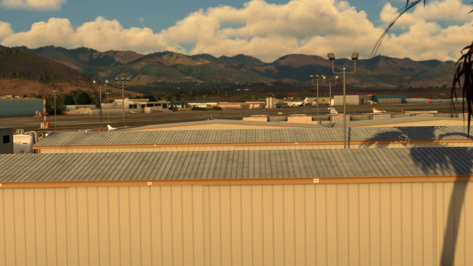
If the terrain model is wrong, the shape is wrong. The pilot trains on an incorrect visual picture and that training carries into the real aircraft. This is particularly problematic at airports where terrain is a defining feature of the approach, places like Innsbruck, Queenstown, Funchal, and Tenerife North.
What we do about it
At PSSW, we treat the terrain model as an instrument accuracy problem, not a visual fidelity problem. The test isn't whether the terrain looks pretty from 10,000 ft. The test is whether a pilot flying the published approach sees the correct visual picture at decision height.
For every airport we build, we validate the terrain model against the published approach plates. We check that the glidepath angle produces the correct sight picture, that terrain features used as visual references are at their charted positions, and that the missed approach climb gradient provides the same visual cues as the real thing.
This matters most for B2B clients who are using our digital twins for actual training or procedure design. If an airline is using our model to brief pilots on a new route, or an airport authority is visualizing a proposed RNAV approach, the terrain has to be right. Not "close enough." Right.
Terrain context at KSBP — the Santa Lucia Range defines every approach
The cost argument
High-resolution terrain data costs more to acquire and process. A 1-meter LiDAR survey of an airport and its approaches is a meaningful expense. But the cost of training on inaccurate terrain is harder to quantify. If a pilot builds the wrong visual picture in the simulator and that picture differs from reality at 200 ft AGL, the cost of that discrepancy is measured in safety margins, not dollars.
For consumer simulation products, we use the best commercially available satellite elevation data and validate it against published charts. For professional B2B projects, we can work with client-provided survey data or commission new surveys to meet specific accuracy requirements. In both cases, the terrain goes through the same validation process.